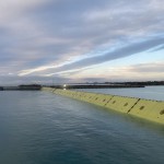
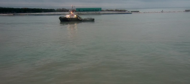
Riceviamo e volentieri pubblichiamo l’articolo scientifico del CNR-IGG riguardo le riprese dal satellite Copernicus Sentinel-2 delle barriere del Mose in funzione il 4 e il 6 novembre.
Qui il link al sito del CNR dell’articolo in italiano.
Copernicus Sentinel-2 satellite captures the flood barriers at work in Venice amid stormy weather
Federica Braga (CNR-ISMAR), Luca Zaggia (CNR-IGG), Gian Marco Scarpa (CNR-ISMAR), and Vittorio Brando (CNR-ISMAR)
“Then Moses stretched out his hand over the sea, and the Lord drove the sea back by a strong east wind all night and made the sea dry land, and the waters were divided.” (Exodus 14:21)
Last week, on November 4th 2021, while the 78 mobile gates of the MoSE, the system for the defence of Venice and the lagoon islands from storm surges, were about to retract in their housing on the bottom of the inlets, the Copernicus Sentinel-2 satellite captured an outstanding image of the upper Adriatic Sea during one of the first events of the season.
The flood barriers were activated on Wednesday 3rd afternoon, based on a forecast that the tide would reach up to 140 cm during the night, when a south-southeasterly wind of more than 15 m s-1 (about 30 knt) battered the Venetian coast (Figure 2). Without them, a tide at that level would have flooded 60% of the city with the ritual major consequences for the iconic tourist attraction of St. Mark’s Square.
The flood barriers were closed during the main peaks of the tide and were partially opened, with only S. Nicolò Channel closed permanently, in the intermediate interval. As shown by the image (Figure 1), at the time of the satellite overpass (10:11 UTC) the flood barriers were still closed at Chioggia and apparent in the imagery as a yellow solid sea-wall while in Malamocco they were already underwater retracting into their housing on the seafloor. At the inlet of Lido the barriers were instead in the early phases of movement: some barriers were still partly visible under the surface at Treporti Channel, while most barriers were just under the water surface at S. Nicolò Channel.
The different timing of the operations in the inlets clearly affects the patterns of water turbidity, as apparent in the 10 m spatial resolution Sentinel-2 image and turbidity maps of Figure 1. For instance, in the inlet of Chioggia the turbidity is slightly higher on the sea side of the gates. In the inlet of Malamocco a zig-zag pattern is visible at the centre of the channel, where the accumulated sediments are likely mobilized by the turbulence associated with the retreat of the gates. In the Lido inlet, it is noteworthy the peculiar behaviour of the S. Nicolò Channel where the different relative position reached at the time of acquisition by the 20 mobile gates force the flow to move through openings of variable depth, creating a sawtooth-like pattern in the turbidity front. Another outstanding feature of the image is the low turbidity of the seawater trapped into the refuge harbours of the navigation locks in Malamocco and Chioggia inlets, that are hydraulically isolated from the circulation in the nearby channels.
An example of the typical situation of a closed lagoon is captured by the NASA Landsat 8 image acquired on November 6th at 9.52 UTC, where all the barriers were in the working position in all the three inlets appearing in the imagery as yellow sea-walls. At the time of satellite overpass the wind was from northeast with a speed of about 17 m s-1 determining high turbidity values along the coast as well as in the lagoon due to sediment resuspension over the tidal flats.
The fine spatial resolution of these satellite imagery and of the derived products can be considered a key element for the effective management of coastal resources as communities worldwide are taking actions to protect from the effects of sea-level rise, as shown by this particular case-study.
Acknowledgements
The European Space Agency and the European Union’s Copernicus programme are thanked for the acquisition and free distribution of Sentinel-2 images used in this work. Landsat 8 data was obtained from the U.S. Geological Survey – Earth Resources Observation and Science (EROS) Center. Tidal levels and wind data covering the study area were provided by the Centro Previsione e Segnalazione Maree of the city of Venice. The acquisition and elaboration of satellite images of the Venice lagoon is performed by CNR-ISMAR and CNR-IGG with the contribution of the Provveditorato for the Public Works of Veneto, Trentino Alto Adige, and Friuli Venezia Giulia, provided through the concessionary of State Consorzio Venezia Nuova and coordinated by CORILA in the framework of the Venezia2021 Research Program. This work is also supported by the European Union’s Horizon 2020 – Research and Innovation Framework Programme (CERTO project, grant number 870349).


